Innovation
MES is an innovative system that helps modellers, planners, policy makers, and other decision makers to achieve their modelling objectives in an effective and efficient way.


Alberta Modelling Expert System (MES) is a user-friendly, GIS-based,
web application designed to manage all the relevant modeling knowledge, information and data.
MES will not only help modellers, planners, policy developers, and other decision makers
in effectively and efficiently identifying appropriate modelling tools for a set of objectives,
but also in determining data availability for their modelling work.
Moreover, MES can access the relevant information of completed modelling projects for a specific
geographic area in Alberta. MES will benefit users right from model selection to identifying data
and information gaps long before they consider the viability of using a particular modelling tool
or start gathering data. This in itself will save a lot of time and money, as well as reduce
duplicity of modelling efforts in Alberta.
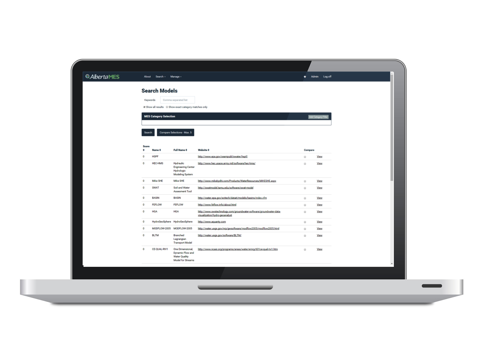
MES contains an Environmental Modelling Tools Catalogue – a searchable modelling tools catalogue capable of storing, organizing, and evaluating all relevant information on available modelling tools in support of various business areas.
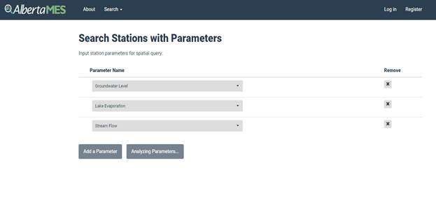


MES contains a Metadata Catalogue of Environmental Monitoring Networks in Alberta – a GIS-enabled searchable system that stores and organizes all relevant metadata of environmental monitoring networks in Alberta operated by Government of Alberta and other key stakeholders.
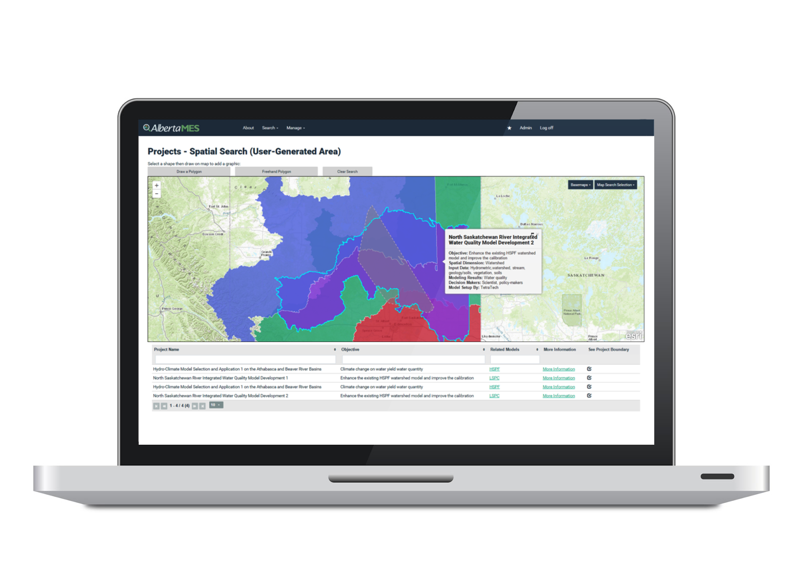
MES contains a Centralized Modelling Repository System – a GIS-enabled searchable repository system that archives completed modeling projects spatially across the province, including information about modeling tools, their applications, limitations, input and output files, maps, figures, reports, etc.

MES is an innovative system that helps modellers, planners, policy makers, and other decision makers to achieve their modelling objectives in an effective and efficient way.
MES includes modelling information and knowledge pertaining to all media, including air, land, water, and biodiversity that can be used by various business areas in integrated resource management.
MES provides a platform to modelling experts and policy makers to work together to tackle modelling challenges and share information and knowledge.